7 HILLTOP DR
Owner Information
MOGILICHERLA SUNITHA
7 HILLTOP DR
BURLINGTON, MA 01803


Property Details
7 HILLTOP DR is classified as a Single Family Residential (Ranch).
The primary structure on this property was built in 1960. There are 925ft2 of built area within this property. There is 925ft2 of residential/living space within this property. This property is listed as having 5 rooms.
7 HILLTOP DR is valued at $414,600. The land is valued at $264,300 and the structures are valued at $150,300.
This property is in Zone RO. Confirm with local Zoning Board authorities to ensure there are no overlays or other easements on this property.
The most recent deed for 7 HILLTOP DR is recorded at the local registrar in Book 31444, Page 001. 7 HILLTOP DR was last sold on Friday, May 26, 2000 for $242,500.
Assessment data from fiscal year 2022.
Flood Data
According to the FEMA National Flood Hazard Layer, this property does not appear to be in a flood zone. It may also be in an area not yet reviewed. Nonetheless, confirm this information prior to taking any action.
To view the flood hazards around this property, create a FEMA "Firmette" Map of the area around 7 HILLTOP DR.
Broadband Internet Providers
| Provider | Type | Bandwidth (mbps) | |
|---|---|---|---|
| VSAT Systems, LLC. | Satellite | 2 | 1 |
| Crown Castle Fiber | Fiber | 0 | 0 |
| Comcast | Cable | 1000 | 35 |
| Verizon New England Inc. | Fiber | 940 | 880 |
| Viasat Inc | Satellite | 100 | 3 |
| RCN | Cable | 500 | 20 |
| HughesNet | Satellite | 25 | 3 |
| GCI Communication Corp. | Satellite | 0 | 0 |
Broadband service provider data from December 2020.
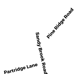
Adjacent Properties
- 2 A PINE RIDGE RD
Single Family Residential owned by LAMONTAGNE BRIAN - 6 PINE RIDGE RD
Single Family Residential owned by CLEMENT CHRISTOPH & A CRUSCO - 9 HILLTOP DR
Single Family Residential owned by ANDREWS NICHOLAS W - 4 PINE RIDGE RD
Single Family Residential owned by STIRLING ALLAN BRUCE - 5 HILLTOP DR
Single Family Residential owned by MALIYA BRIJ M